



































Key Points
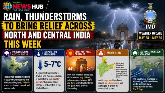
- The IMD has forecast moderate to severe thunderstorms with winds reaching up to 70 km/h across northwest, central, and eastern India between May 28 and 30.
- A significant temperature drop of 5 to 7 degrees Celsius is expected to kick in after May 29, though no major change is anticipated in the next 48 hours.
- Delhi may record its hottest day of the week on May 28 itself, with maximums between 44°C and 45°C, before thunderstorms and gusty winds arrive in the evening.
- An Orange Alert has been issued for Uttarakhand, and alerts are in effect for several hill states.
- The southwest monsoon is advancing, with conditions set to become more favourable in the next 2 to 3 days.
The IMD has issued alerts for heatwave, thunderstorms, lightning, and gusty winds for the national capital on May 28. While morning and afternoon hours are expected to remain hot and dry, with dry northwesterly winds intensifying discomfort levels, thunderstorms and rainfall are expected later in the evening.
Between May 28 and 31, maximum temperatures in Delhi-NCR could drop by up to 8 degrees and minimum temperatures by up to 6 degrees. Light rain with thunder, lightning, and winds gusting at 60 to 70 km/h is forecast for May 28 and 29.
Uttar Pradesh and Bihar to See Storms
Scattered to fairly widespread light to moderate rainfall with thunderstorms, lightning, and gusty winds reaching 40 to 50 km/h is likely over West Uttar Pradesh from May 28 to 31, and East Uttar Pradesh from May 27 to 31. Districts such as Lucknow, Varanasi, Kanpur, and Prayagraj are among those likely to be affected. On May 29 specifically, several districts may witness hailstorms with winds peaking at 70 km/h.
In Bihar, the Patna Meteorological Department has forecast a drop of 2 to 4 degrees Celsius in maximum temperatures over the next 2 to 3 days. Light to moderate rain is likely in the north-central and northeastern parts of the state.
Rajasthan Still Scorching, Partial Relief Ahead
Rajasthan remains gripped by an intense heatwave, with temperatures in Sri Ganganagar soaring as high as 48.2°C. A dust storm is expected in isolated places over Rajasthan in the coming days. Partial relief in the form of light rain on May 28 and 29 is possible in the Jaipur, Bharatpur, Ajmer, and Bikaner divisions.
Current Temperatures Across Major Cities
| City | Maximum Temperature | Minimum Temperature |
|---|---|---|
| Delhi | 41°C | 26°C |
| Jaipur | 44°C | 30°C |
| Bhopal | 42°C | 29°C |
| Lucknow | 38°C | 34°C |
| Shimla | 30°C | 18°C |
Hill States on High Alert
An Orange Alert has been issued for Uttarakhand for the next two days. Districts including Uttarkashi, Chamoli, and Pithoragarh are likely to see heavy rainfall, lightning, and hailstorms. Hailstorms are also expected in Himachal Pradesh, Punjab, Haryana, and Chandigarh. Rain and hailstorm alerts are in place for areas including Shimla, Kullu, Srinagar, and Ramban through May 29 to 30.
In Maharashtra’s Vidarbha region, a Yellow Alert has been issued from May 29, with strong winds and lightning strikes likely. Light rainfall is also possible in several districts including parts of Hyderabad.
Monsoon Advances on Schedule
Conditions are favourable for the further advance of the southwest monsoon into more parts of the southwest and southeast Arabian Sea, Lakshadweep area, the Bay of Bengal, and some parts of the northeast Bay of Bengal over the next 2 to 3 days. The monsoon has not yet made its official landfall in Kerala, but it is closing in, and meteorologists expect it to become more active very soon.