Key Points
- IMD warns of heavy to very heavy rain in multiple regions today, 22 August, with alerts extending over the next 3–5 days.
- Delhi likely to see cloudy skies with spells of rain and thunderstorms through 25 August; gusty winds possible.
- Western India (Konkan, Goa, Gujarat, Madhya Maharashtra) under very heavy to extremely heavy rain spell in the next 24 hours.
- Hill states (Himachal, Uttarakhand, J&K) forecast heavy rain with thunderstorms through 22–26 August; localized disruption possible.
- UP–Bihar face continued heavy rain risk; flood-like situations reported in parts of both states.
New Delhi: The India Meteorological Department (IMD) indicates the monsoon is intensifying again, with heavy to very heavy rain forecast over large parts of the country today and in the coming days. For 22 August, IMD highlights heavy to very heavy rainfall at isolated places over Bihar, East Madhya Pradesh, East Rajasthan, Gujarat, and parts of the Northeast, alongside heavy rain across Delhi, UP, Uttarakhand, Himachal, J&K, Jharkhand, Odisha, Chhattisgarh, West Bengal–Sikkim, Konkan & Goa, and Madhya Maharashtra. IMD’s extended bulletin (21 August) adds that heavy rain will affect Uttar Pradesh from 21–25 August and Himachal, Uttarakhand, and Rajasthan over the next six to seven days, with very heavy rain at times in East Rajasthan, Punjab, Haryana, and Uttarakhand on specific dates. Western belts including Konkan, Goa, Madhya Maharashtra, and Gujarat are under a high-impact spell with extremely heavy rain potential in the near term.
Delhi-NCR: Wet, Cloudy Spell Through 25 August
IMD’s Delhi forecast shows generally cloudy skies with light to moderate rain/thundershowers, including possible intense spells, from 22–25 August. Gusty winds and thunderstorms could disrupt traffic intermittently. The local forecast for 22 August notes a possibility of very light to light rain/thundershowers with max/min around 35°C/24°C and high humidity; light rain was recorded at select stations on 21 August. Regional media and national outlooks also point to a broader wet spell across North India into next week.
Himachal Pradesh: Heavy to Very Heavy Rain Windows
The Meteorological Centre Shimla bulletin indicates heavy rain with thunderstorms today, escalating to heavy to very heavy rain at isolated places from 23–26 August. The advisory urges caution in vulnerable districts given the likelihood of intense spells and associated risks like landslides and road disruptions. IMD’s national guidance also flags sustained rain across Himachal 22–26 August.
Uttarakhand: Persistent Heavy Rain Risk
Uttarakhand is in line for heavy rain during 22–25 August per IMD’s extended outlook, with thunderstorms and lightning likely. Terrain-related hazards and rapid water rises in hill streams remain key risks during intense spells.
Uttar Pradesh: Widespread Heavy Rain; Disruption Possible
IMD lists Uttar Pradesh among states with heavy rainfall likely today and continuing episodes through 25 August. Thunderstorms with lightning and gusty winds (30–40 km/h) may accompany showers, affecting movement and low-lying pockets. Localized flood-like situations have emerged in parts of the state amid recent heavy rains.
Bihar: Heavy to Very Heavy Rain at Isolated Places
For 22 August, IMD places Bihar in the “heavy to very heavy” category at isolated locations, with thunderstorms, lightning, and gusty winds also possible. Waterlogging and flash flood risks are elevated where intense cells persist. National coverage similarly highlights multiple eastern belts, including Bihar, under heavy rain through 24 August.
Madhya Pradesh: Mixed Relief with Targeted Heavy Pockets
While some respite is expected in parts of MP, IMD warns of heavy to very heavy rain at isolated places in East MP on 22 August and heavy rain possible in West MP as well. Gusty winds may accompany storms in pockets.
Rajasthan: East Under Very Heavy Rain; West Also Active
IMD forecasts heavy to very heavy rain at isolated places over East Rajasthan on 22 August, with heavy rain also likely over West Rajasthan. The extended outlook maintains a wet pattern over Rajasthan for the next several days, including specific heavy days in the west on 23–24 August. Media advisories also note continued risk of localized urban flooding where intense spells occur.
Western India Focus: Konkan, Goa, Gujarat, Madhya Maharashtra
Western coastal and adjoining regions are primed for very heavy to extremely heavy rainfall over the next 24 hours per IMD-linked reports, with likely urban flooding and travel disruptions. Authorities advise caution, especially in low-lying and landslide-prone zones.
Northeast and East India
Heavy rain continues across Assam, Meghalaya, Arunachal Pradesh, Nagaland, Manipur, Mizoram, and Tripura, with very heavy rain pockets in parts of the region on 22 August. Thunderstorms with lightning are expected to accompany many of these spells.
City/State Quick Guide
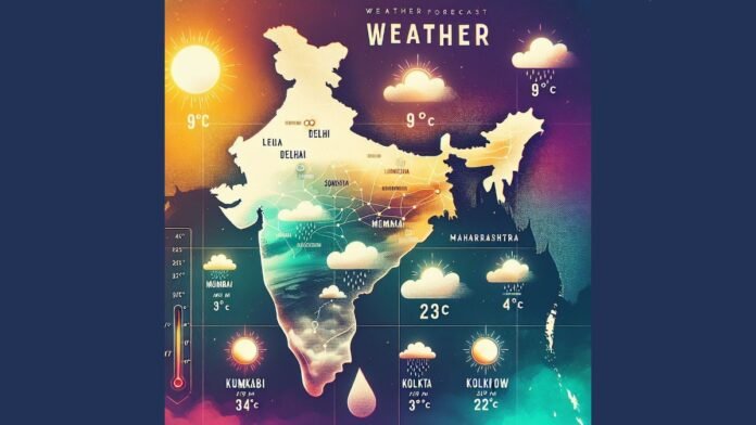
- Delhi-NCR: Cloudy with light to moderate rain/thundershowers; intense spells possible 22–25 Aug; humidity stays high.
- Himachal Pradesh: Heavy rain today; very heavy rain possible 23–26 Aug; landslide-prone areas on alert.
- Uttarakhand: Heavy rain likely 22–25 Aug with thunderstorms/lightning; watch hill streams and slopes.
- Uttar Pradesh: Heavy rain likely today and through 25 Aug; localized flooding and traffic impacts possible.
- Bihar: Heavy to very heavy rain at isolated places today; thunderstorms/lightning risk in several districts.
- Madhya Pradesh: Heavy to very heavy rain at isolated places in East MP today; scattered heavy rain risk elsewhere.
- Rajasthan: Heavy to very heavy over East Rajasthan; heavy rain possible in West Rajasthan; next 2–3 days remain active.
- Konkan, Goa, Gujarat, Madhya Maharashtra: Very heavy to extremely heavy rain over next 24 hours; urban flooding risk.
Safety Advisory
- Avoid waterlogged, low-lying stretches during intense showers; keep alternate routes ready.
- Expect gusty winds (30–40 km/h) with thunderstorms in parts; secure outdoor items.
- Hill travel: check local advisories for landslides, road closures, and rising river levels before movement.


