- The earthquake occurred at a depth of 32 km (20 mi) and was felt across the island of Mindanao and nearby areas.
- The Philippine seismology agency warned of possible tsunami waves up to three meters (10 feet) high along the coast of Mindanao and other parts of the country.
- The Japanese broadcaster NHK also reported that tsunami waves up to one meter (3 feet) high could reach Japan’s west coast early Sunday morning.
- The US Geological Survey said there was no tsunami threat to the US and its territories.
New Delhi: A powerful earthquake of 7.5 magnitude struck Mindanao, Philippines on Saturday night, triggering a tsunami alert for the Philippines, Japan, and the US.
Earthquake details
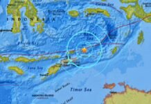
The earthquake occurred at 10:37 p.m. local time (1437 GMT) on Saturday, December 4, 2023, according to the US Geological Survey (USGS). The epicenter was located about 65 km (40 mi) southeast of Cotabato City, Mindanao, Philippines. The earthquake had a depth of 32 km (20 mi) and was followed by several aftershocks.
The earthquake was felt strongly across Mindanao and nearby islands, such as Basilan, Sulu, and Tawi-Tawi. It also shook parts of Visayas and Luzon, including Cebu, Iloilo, Negros, Bohol, Leyte, Samar, Metro Manila and Batangas. The intensity of the shaking ranged from weak to very strong, depending on the distance from the epicenter.
The earthquake caused power outages, landslides, cracks in roads and buildings, and panic among the residents in some areas. However, there were no immediate reports of major damage or casualties.
Tsunami alert
The Philippine Institute of Volcanology and Seismology (PHIVOLCS) issued a tsunami alert for the coastal areas of Mindanao and other parts of the Philippines, such as Palawan, Sulu, Tawi-Tawi, Basilan, Zamboanga, Davao, Sarangani, South Cotabato, Sultan Kudarat, Maguindanao, Lanao del Sur, Lanao del Norte, Misamis Occidental, Misamis Oriental, Camiguin, Surigao del Norte, Surigao del Sur, Agusan del Norte, Agusan del Sur, Dinagat Islands and Siargao.
PHIVOLCS said tsunami waves could reach up to three meters (10 feet) high and could arrive within an hour after the earthquake. It advised the public to stay away from the shore and seek higher ground. It also warned of possible strong currents and sea level changes along the coast.
The Japan Meteorological Agency (JMA) also issued a tsunami advisory for the west coast of Japan, including the prefectures of Aomori, Iwate, Miyagi, Fukushima, Ibaraki, Chiba, Tokyo, Kanagawa, Shizuoka, Aichi, Mie, Wakayama, Osaka, Hyogo, Kyoto, Nara, Tokushima, Kagawa, Ehime, Kochi, Oita, Miyazaki and Kagoshima.
JMA said tsunami waves up to one meter (3 feet) high could reach Japan’s west coast around 1:30 a.m. local time (1630 GMT Saturday). It advised the public to avoid the coast and rivers and to follow the instructions of the local authorities.
The US National Tsunami Warning Center (NTWC) said there was no tsunami threat to the US and its territories, such as Alaska, Hawaii, Guam, American Samoa, and Puerto Rico.

Previous earthquakes
The Philippines is located in the Pacific Ring of Fire, which is the most seismically and volcanically active region in the world. The country experiences frequent earthquakes due to the movement of several tectonic plates, such as the Philippine Sea Plate, the Eurasian Plate, the Pacific Plate, and the Indo-Australian Plate.
The last major earthquake that hit the Philippines was on November 17, 2023, when a 6.7 magnitude earthquake struck the southern island of Mindanao, killing eight people and injuring 13 others. The earthquake also damaged more than 50 houses and other buildings and caused power outages and landslides.


