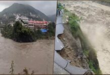
Kanpur: The recent earthquake that rocked Nepal and killed over 150 people has raised concerns about the seismic activity in the region and its impact on India. A study by the Indian Institute of Technology (IIT) Kanpur has warned that the Nepal quake could also affect the state of Uttarakhand, which lies in the same Himalayan belt.
The study, conducted by Professor Javed Malik and his team from the Department of Earth Sciences, has found that the earthquakes occurring in Nepal are moving towards the west, and if they continue to do so, they could trigger a major quake in Uttarakhand. The study has also identified the fault lines where the tectonic plates may shift in the future, posing a threat to the population and infrastructure.
Professor Malik said that the occurrence of multiple earthquakes of lower magnitude at one place is a matter of concern, as it indicates the build-up of stress in the earth’s crust. He said that such earthquakes could also lead to a bigger earthquake, which could be devastating for the region. He cited the example of the 2015 Nepal earthquake, which was preceded by several smaller quakes and aftershocks, and killed around 9,000 people and injured more than 22,000 others.
He said that Uttarakhand, which is also located in the active Himalayan zone, is vulnerable to earthquakes, and the Nepal quake could have an effect on it. He said that his study has mapped the fault lines in Uttarakhand, which are the areas where the earth’s crust is fractured and can slip during an earthquake. He said that his study has also estimated the magnitude of the potential earthquakes that could occur along these fault lines.
He said that his study will help urban developers and planners to design and construct earthquake-resistant buildings and projects, and to avoid heavy construction and development in high-risk areas. He said that his study will also help the disaster management authorities to prepare and respond to any earthquake emergency in the future.

He said that his study is based on the data collected from various sources, such as satellite imagery, field surveys, geological maps, and historical records. He said that his study is also supported by the latest technology, such as the Global Positioning System (GPS), which can measure the movement and deformation of the earth’s surface.
He said that his study is part of a larger project funded by the Ministry of Earth Sciences, which aims to assess the seismic hazard and risk in different parts of India. He said that his study is one of the first of its kind in India, and will contribute to the scientific knowledge and understanding of the earthquake phenomenon in the country.


