Key Points:
- 109% above-normal rainfall expected in September 2025, breaking records as monsoon withdrawal delayed by two weeks
- Red alerts issued for Himachal Pradesh, Uttarakhand, Madhya Pradesh and parts of Uttar Pradesh with extremely heavy rainfall (21cm+)
- Fresh low-pressure system forming over Bay of Bengal will intensify rainfall across Indo-Gangetic plains from September 3-7
- Delayed monsoon withdrawal: Normal September 1st retreat now pushed to September 17th due to western disturbance interactions
- 12 states under weather warnings: From Jammu & Kashmir in north to Karnataka in south, covering 60% of India’s landmass
- Downstream flooding threat: Rivers originating in Uttarakhand expected to flood, impacting Delhi NCR and northern plains
- Agricultural impact: Heavy rains damaging kharif crops in Punjab while benefiting water-stressed regions
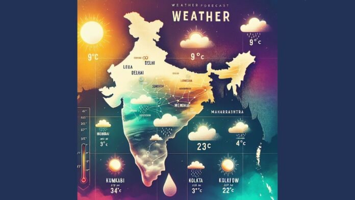
New Delhi: The India Meteorological Department (IMD) has issued an unprecedented weather warning as the country prepares for what could be the wettest September in over two decades. With monthly rainfall expected to exceed 109% of the long-term average of 167.9mm, millions across North, Central, and Western India face continued monsoon fury well into the traditional post-monsoon period.
Unprecedented Weather Pattern Shift
IMD Director General Mrutyunjay Mohapatra has confirmed a significant shift in India’s monsoon patterns, with September rainfall showing a rising trend since 1980, particularly intensifying over the past five years. The normal monsoon withdrawal date has been pushed back from September 1st to September 17th, indicating extended rainfall activity across the subcontinent.
“September is a transitional month. One factor may be the interaction of western disturbances with monsoon during this month,” Mohapatra explained, highlighting the complex meteorological dynamics driving this unusual weather pattern.
Critical Weather Alerts Across Multiple States
Northwest India: Red Alert Territory
The most severe warnings have been issued for Himachal Pradesh and Uttarakhand, where extremely heavy rainfall exceeding 21cm is forecast for September 3rd. These hill states, already reeling from August’s wettest conditions since 2001, face heightened risks of:
- Flash floods and landslides in mountainous terrain
- Road cave-ins and infrastructure collapse
- Disruption to pilgrimage routes and tourism activities
Punjab, western Uttar Pradesh, Haryana, Chandigarh, and eastern Rajasthan remain under heavy rain warnings from September 3-6, with continued precipitation expected in Jammu and Kashmir.
Central and Eastern India: Monsoon Intensification
A fresh low-pressure system developing over the northwest Bay of Bengal is set to track across Odisha, Chhattisgarh, and Madhya Pradesh, bringing extremely heavy rainfall to isolated areas on September 3rd. This system will particularly impact:
- Chhattisgarh: Extremely heavy rains expected, raising concerns for the upper Mahanadi river catchment
- Odisha: Intense rainfall activity from September 2-4
- Madhya Pradesh and Vidarbha: Heavy to very heavy showers continuing through the week
Western India: Extended Monsoon Activity
Maharashtra and Gujarat continue experiencing monsoon’s full fury, with heavy to very heavy rains forecast for Konkan-Goa and Marathwada from September 3-5. Gujarat faces extremely heavy rainfall warnings between September 4-6, extending to Saurashtra and Kutch regions through September 7.
Southern Peninsula: Coastal Concerns
Kerala, coastal Andhra Pradesh, Telangana, and coastal Karnataka remain under heavy rain alerts from September 2-4, while northern interior Karnataka faces similar conditions. However, parts of extreme southern India may experience below-normal rainfall as the monsoon’s southern reach weakens.
Downstream Flooding: Delhi NCR on High Alert
The IMD has issued specific warnings about downstream flooding risks, particularly affecting the National Capital Region. “Many rivers originate in Uttarakhand. So, heavy rainfall means many rivers will be flooded and it will impact cities and towns downstream,” Mohapatra cautioned.
Delhi and surrounding areas face:
- Generally cloudy skies with light to moderate rainfall through September 5th
- Maximum temperatures between 29-34°C, remaining below normal
- Potential heavy showers during afternoon and evening hours
- Enhanced flood preparedness as Haryana releases record water volumes
Agricultural and Economic Implications
The extended monsoon presents a double-edged scenario for India’s agricultural sector. While the above-normal rainfall significantly benefits water resources and late-sown kharif crops, it has already caused substantial damage in Punjab, where widespread flooding has impacted standing crops.
Union Minister of Agriculture and Farmers Welfare has convened emergency meetings to assess crop damage and discuss compensation measures for affected farmers. The timing is particularly crucial as harvest season approaches for major kharif crops including rice, sugarcane, and cotton.
Infrastructure and Transportation Challenges
The prolonged rainfall is creating significant infrastructure challenges across multiple states:
- Transportation disruptions due to waterlogged roads and damaged bridges
- Power supply interruptions from fallen trees and damaged transmission lines
- Communication network issues in remote and hilly areas
- Supply chain disruptions affecting essential commodities
The IMD has advised fishermen to avoid venturing into the Arabian Sea from September 1-6 due to rough sea conditions associated with the active weather systems.
Climate Change Implications
This unprecedented September rainfall pattern reflects broader climate change impacts on India’s monsoon system. The interaction between traditional monsoon patterns and western disturbances is creating more intense and prolonged rainfall events, challenging existing infrastructure and disaster preparedness systems.
Scientists note that such extended monsoon activity could become more frequent, requiring enhanced early warning systems and improved flood management infrastructure across the country.
Emergency Preparedness and Response
Authorities across affected states have been placed on high alert with disaster response teams pre-positioned in vulnerable areas. The IMD emphasizes the critical need for:
- Reinforced infrastructure in flood-prone areas
- Enhanced surveillance and conservation efforts
- Robust response systems in vulnerable sectors
- Utilization of early warning systems for timely evacuations
As India navigates this extended monsoon period, the focus remains on minimizing loss of life and property while managing the complex balance between beneficial agricultural impacts and potentially devastating flooding across the world’s most populous nation.
The coming week will be critical as multiple weather systems converge across the subcontinent, testing the resilience of both natural ecosystems and human infrastructure in what meteorologists are calling an unprecedented September weather event.


